On April 4, the English Daily Times Of India shared a wrong map of Pakistan in which they had given away Pakistan Occupied Kashmir (PoK) to Pakistan. The report was about the increasing crisis in the neighbouring country, and while talking about the possibility of economic crisis and strategic weakness, Times of India shared the wrong map of Pakistan.
Times of India has published wrong map of Pakistan, showed PoK as part of Pak@TOIIndiaNews @timesofindia, apologise & correct the image.
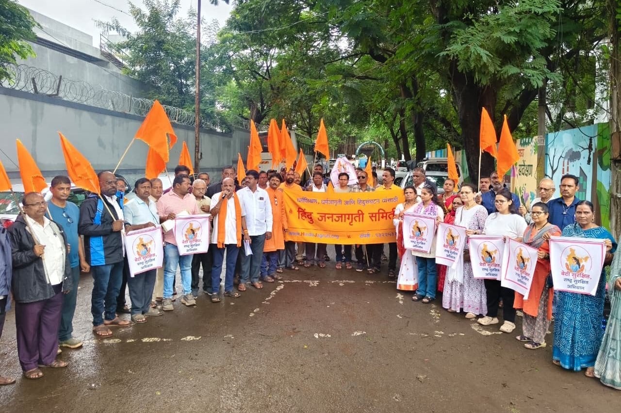
Request @MIB_India @HMOIndia to look into this; @ianuragthakur please penalise those who publish distorted maps of India https://t.co/KIXTJY8M7T
— HinduJagrutiOrg (@HinduJagrutiOrg) April 4, 2022
The cartoon that TOI published in the tweet covered a significant portion of J&K and Ladakh (Gilgit-Baltistan). The Archived version of the tweet can be seen here.
Entire portion of Kashmir that has been illegally occupied by Pakistan and China is an integral part of India.
Netizens criticized TOI over the wrong map
Several netizens pointed out the wrong map and criticized Times Of India for the blunder. Twitter user iMac_too questioned TOI if they had donated PoK to Pakistan.
Slave @vineetjaintimes, have you donated POK to Pakistan? https://t.co/wv90UrsXI5
— iMac_too (@iMac_too) April 4, 2022
Another Twitter user Akshay tagged PMO and HMO in the tweet and urged TOI to correct the cartoon.
Dear @TOIIndiaNews @timesofindia , please correct your cartoon. Gilgit-Baltistan are part of India. They are not a part of Pakistan.@MHAIndia @AmitShah @PMOIndia please note. https://t.co/LIP6WButjf
— Akshay (@RamSuby) April 4, 2022
A Twitter user questioned if the law against publishing a wrong map of India was only for the general public or media houses were covered under that too.
@ianuragthakur ji is their any law against those who publishes doctored map of india ? Or rules only for poor common ppl ? @MIB_India https://t.co/pQPumBV5j3
— An Indian ?? (@trueindian1978) April 4, 2022
Twitter user Chaitanya told TOI to learn to use the correct map.
First learn to show map correctly … ?
— Chaitanya (@shreechaitanya) April 4, 2022
A history of news agencies publishing wrong maps of India
This is not the first time a news agency has shown the wrong map depicting PoK as part of Pakistan. In the past, India Today, CNN, Aaj Tak, Google and Twitter have made blunders in a similar manner. In April 2020, India Today showed a distorted map of India in a graphic during a show hosted by Rajdeep Sardesai.
In August 2017, CNN posted the wrong map of India on Independence Day. The map was changed after the uproar. In December 2020, Aaj Tak streamed the wrong map of India while discussing Bharat Bandh. In July 2020, showed the wrong map of India while covering death of rare Rinos in Assam. In June 2021, BBC showed the wrong map of India while covering the Delta variant of Covid-19.
In June 2021, Google showed the wrong map of India, depicting Pakistan Occupied Kashmir and Aksai Chin as separate entities and not a part of the Indian Union. In June 2021, Twitter committed the same mistake and showed a distorted map of India in the career section on its website. Notably, Twitter has been a repeat offender in this context.
Source : OpIndia